What is an Inclinometer?
When navigating the complexities of motion sensing and navigation systems, it is essential to understand the distinctions between devices and systems like Inertial Measurement Units (IMUs), Inclinometers, Roll & Pitch sensors, Vertical Reference Units (VRU), Attitude and Heading Reference Systems (AHRS), Motion Reference Units (MRUs), Gyrocompasses, and GNSS-Aided Inertial Navigation Systems (GNSS/INS). Each serves specific purposes and offers different levels of functionality, accuracy, and application scope.
Inclinometer
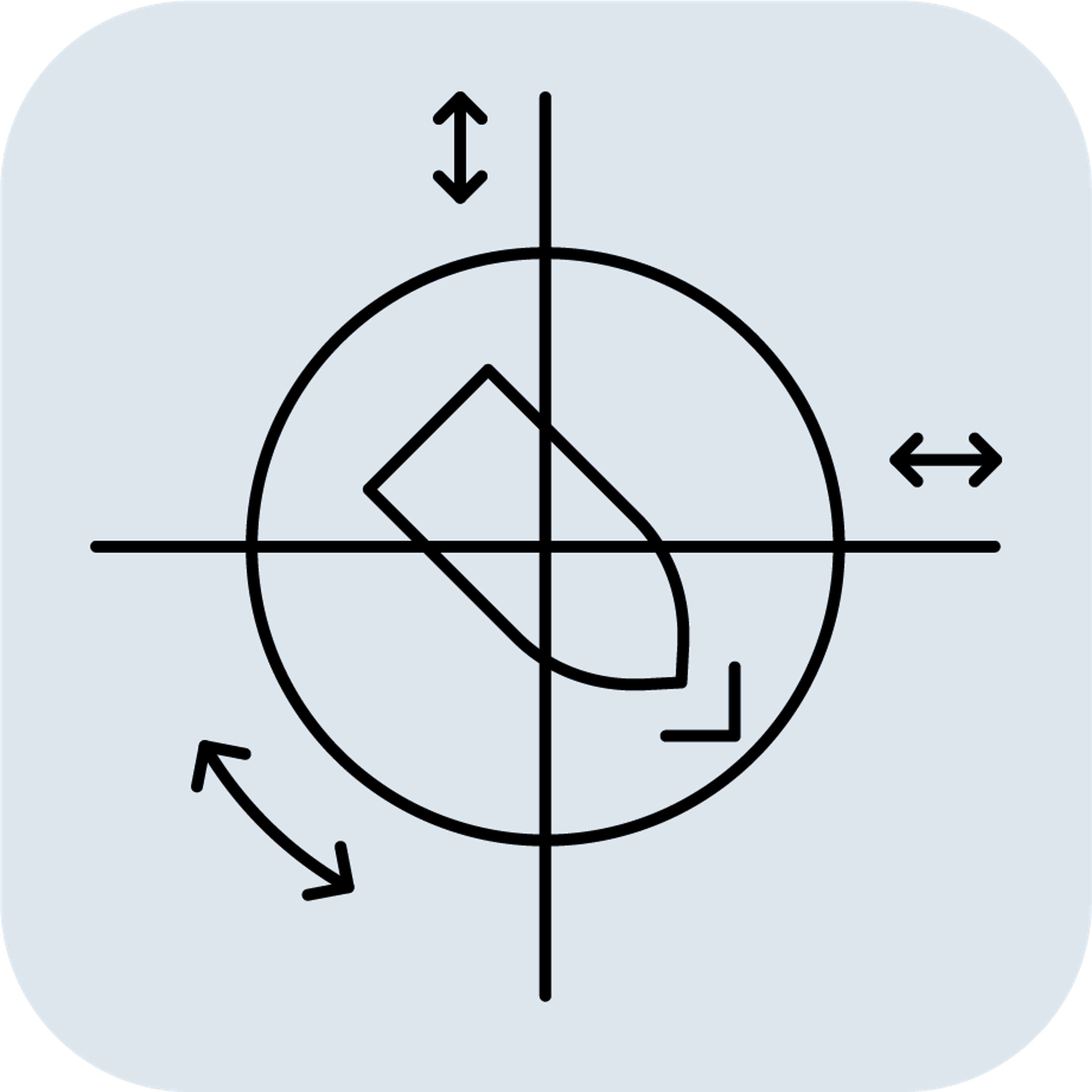
Definition: An Inclinometer, also known as a tilt or level sensor, measures the angle of inclination or tilt of an object with respect to gravity. It determines the angle between the sensitive axis of the device and Earth's vertical direction (gravity vector). It is important to note that an Inclinometer only measures static angles, and therefore cannot provide accurate data in dynamic conditions involving movements or vibrations. Inclinometers are generally less expensive due to simpler components.
Key Features:
Sensors Included: Primarily uses accelerometers to detect gravity's direction.
- Output: Measures static angles accurately when the device is stationary.
- Functionality: Determines roll and pitch in static conditions, but lacks accuracy in dynamic settings.
- Applications: Used in systems that are stationary or moving very slowly and do not experience vibrations.
Example Uses:
- Simple Leveling: Leveling equipment that is not in motion.
- Monitoring Tilt: For structures, bridges, and buildings.
- Measuring Slope: Useful for landslide-prone areas.
Selecting the appropriate sensor depends on the required measurements, environmental conditions, and budget.
- Use an IMU when you need raw acceleration and rotational data.
- Use an Inclinometer for simple, static tilt measurements.
- Use a Roll & Pitch Sensor for lower-level attitude measurements in a dynamic setting.
- Use a VRU when precise roll and pitch measurements are needed in a dynamic environment.
- Use an AHRS for roll, pitch, and heading data.
- Use an MRU for comprehensive motion data in dynamic marine environments.
- Use a Gyrocompass for accurate true north heading.
- Use a GNSS/INS for continuous, absolute position, velocity, and orientation data.